


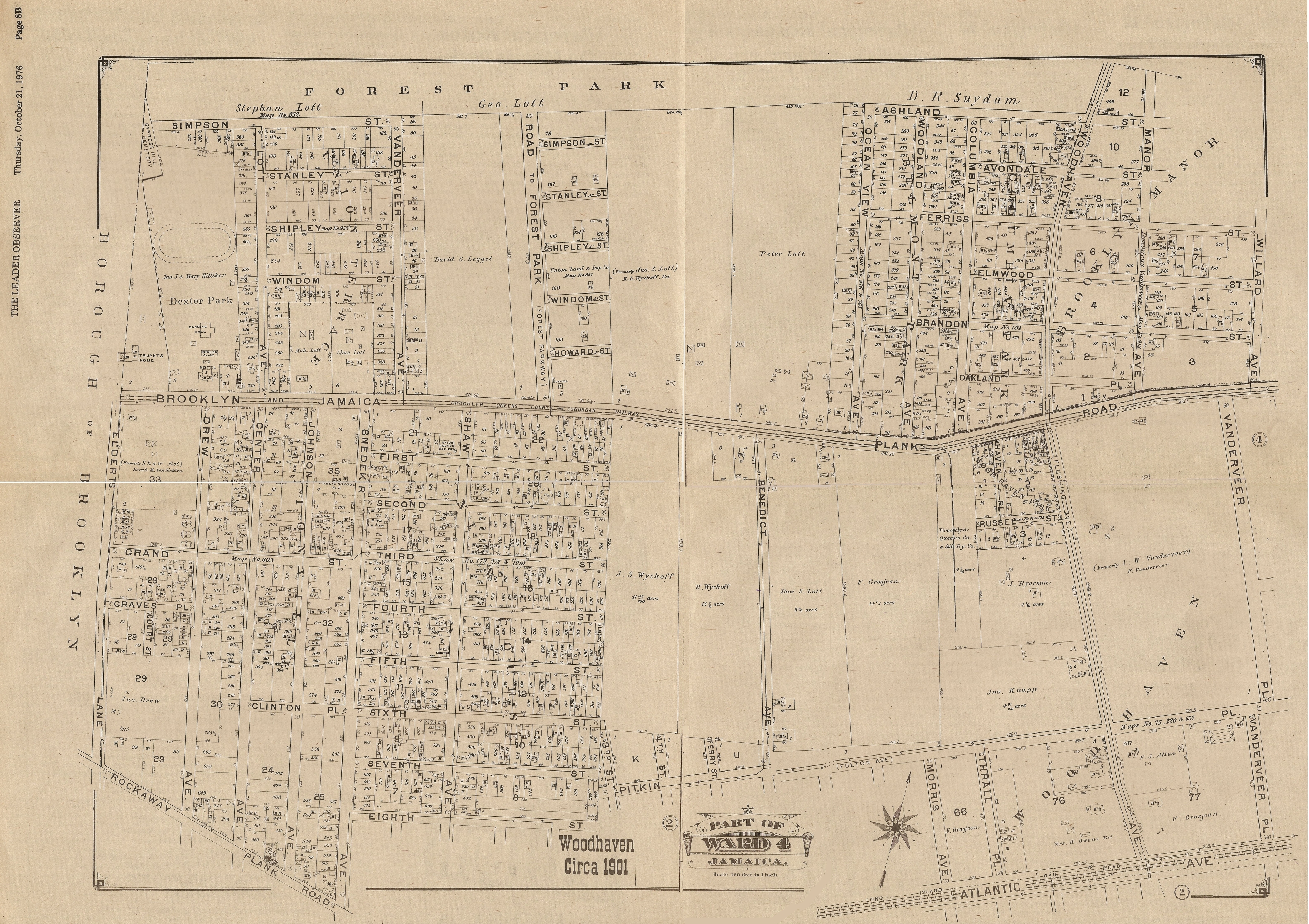
1901 Map of Woodhaven
If you're a fan of Woodhaven History -- or a fan of old maps -- you'll enjoy this entry. This is a reproduction of a 1901 Map of Woodhaven, from the pages of a bicentennial edition of the Leader-Observer. It was originally a centerfold (see below) which led to it being scanned in 4 pieces. At the bottom of this piece is a link to a super-sized image of the map.
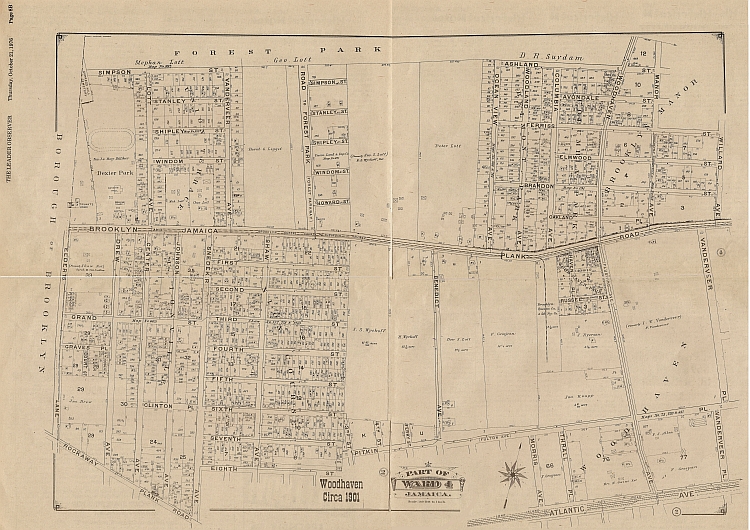
Many of the early notable names in Woodhaven's history can be found on this map, such as Wyckoff and Lott and Vanderveer and Pitkin. Many of these men -- or their families -- bought and sold much of the land in Wooodhaven. And many of them named streets and avenues after themselves, though most of the names -- such as Isaac Vandermeer who had a few streets with his name of it -- have been lost over time as Woodhaven switched from named streets to numbered. Probably the last remnant of a founder's name would be Pitkin Avenue in Ozone Park, named after John Pitkin, often called the "founder" of Woodhaven.
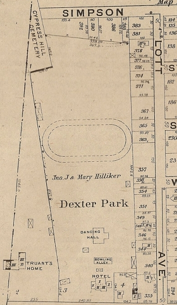
These maps offer an interesting glimpse at the past. For example, the section below shows the layout of Dexter Park circa 1901, before there was a baseball field there. What's real interesting about this piece of the map is how it shows the layout of Dexter Park itself, where the track lay in relation to the dancing hall, the bowling alley, and the hotel. And just to the side, where Franklin K. Lane would one day sit, it is noted where the "Truant's Home" lived (it would later be destroyed in a fire).
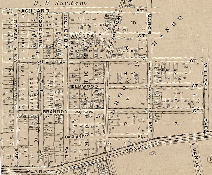
Here's another interesting section, showing the intersection of Jamaica Avenue (aka Plank Road) and Woodhaven Boulevard. It wasn't just the streets that had names -- the cross-streets (the avenues and the drives and ther roads) also had names, also lost over time. Some names, however, hung around for a while. Willard Avenue was the location of the Willard Theater, which many years later became Le Cordon Bleu on 96th Street.
Here's a look at a map for the same piece of land today.
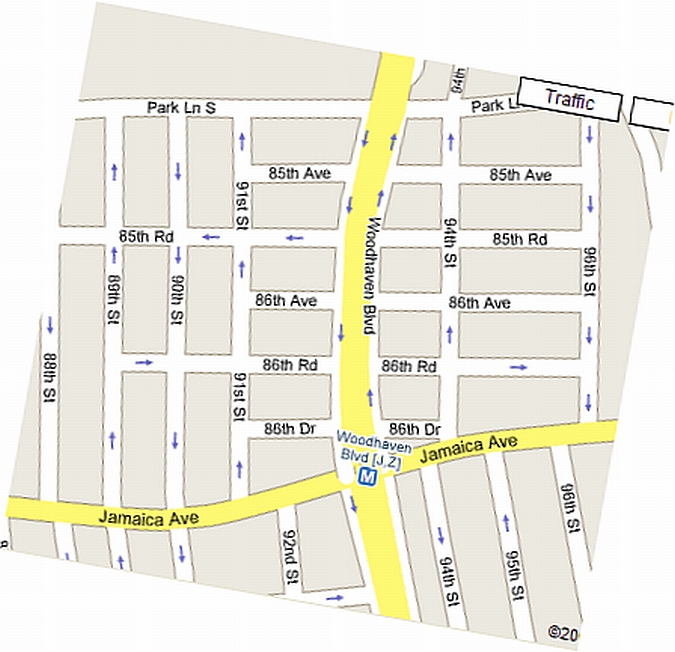
I'll admit -- the number scheme is much easier to follow, but the name scheme had class. It'd be really nice if someday, as they replace the street signs, they add the old name of the street beneath the number. Click on the link below for the large, super-sized version of the map. It's quite large -- so give it a few minutes to load. Also, after it loads it may shrink to fit your browser -- click on it to restore it to its' real size.
Click Here To View The 1901 Map Super Sized
And once again, thanks to Joe Virgona for today's contribution!
Related Topics:
Woodhaven Mapped - Promotional Map of Woodhaven Circa Early 1980s
Woodhaven Panorama - A look at the panorama at the Queens Museum of Art
Ridgewood Savings Bank Map - Circa 1940
If you have any comments, or would like to suggest other projects, drop us a line at info@projectwoodhaven.com or projectwoodhaven@aol.com.
![]()
Return to Project Woodhaven's Home Page