


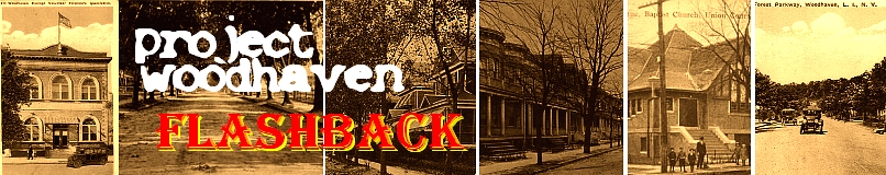
This will be a multi-part post as we have some good material to cover. These are various glimpses into Woodhaven's past -- and some of the images will raise questions we don't have answers for . . . yet. First up is an old postcard, looking down Jamaica Avenue, from 86th Street. This was, clearly, before the El train was built. Look at how wide open the avenue appears, compared to today.
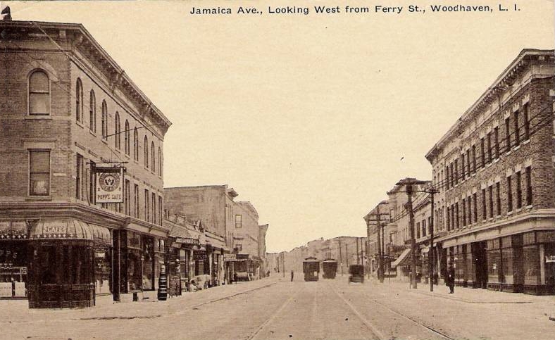
At left in the image above is an old friend, Pop's Restaurant -- except that back then, it was Popp's. We did a little experiment and tried to take a picture from roughly the same spot, and match them up. Keep your eye on the apartment windows above Pop's -- and you'll see that we have them matched up pretty well -- what a difference 100 years makes, eh?
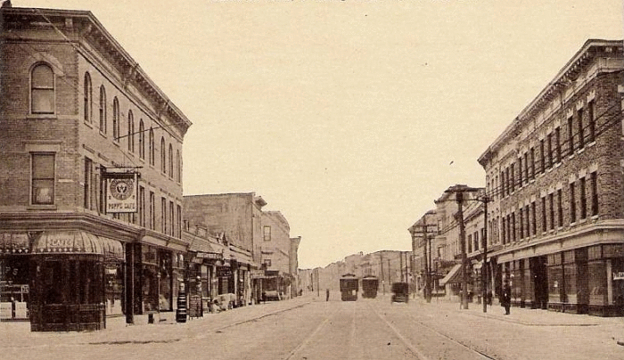
Next up is a shot of Woodhaven Avenue, better known today as Woodhaven Boulevard. After this picture was taken, this road would first get paved -- and then in the 1930's, it would go through a major expansion to the width that it is today. That expansion would necessitate the removal of homes and farms and even a church. For another look at Woodhaven Boulevard, before the expansion, click here.
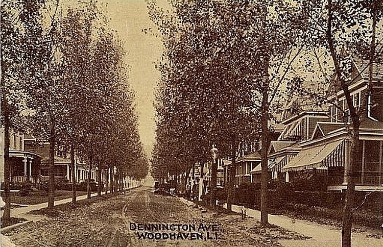
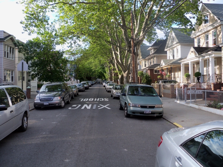
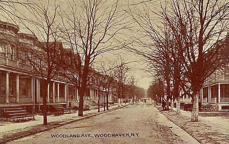
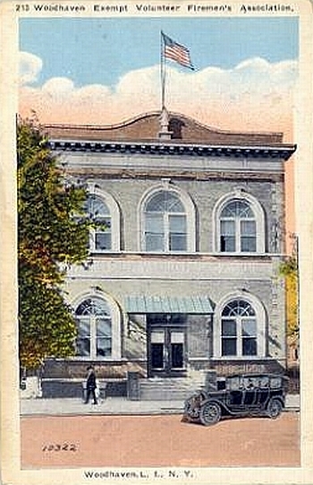
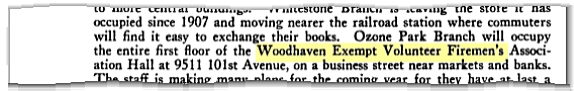
Below is a shot of Dennington Avenue, or as it later became known as -- 88th Street. Check out those wonderful awnings -- you don't see awnings on houses anymore and that's a shame. They'd keep your house cooler in the summer and you would use less energy on air conditioners, etc. Plus, they look real nice. We took some time to explore this street -- and we think this picture was taken about 150 feet North of Jamaica Avenue (looking up towards the park) -- check out the houses on the right hand side of each picture to see if you agree. What ended up convincing us was the 3rd Floor window of the first house on the right -- it juts out differently than the house next to it. Compare it to the old picture, and it looks like it juts out there, as well. Hard to be 100% sure -- any thoughts? Next up is Woodland Avenue, or 90th Street as it is known today. We explored this street, and while we think this was also taken near Jamaica Avenue looking towards the park, we lack the familiarity with this street that someone who lived there would have. Perhaps someone will send us an address of one of the houses and we can try and get a good "then and now" pic. A lot of the steps leading to the porches don't have railings -- I wonder if these houses were newly built. Next up is the "Woodhaven Exempt Volunteer Fireman's Association." It's such a nice looking building that it's hard to imagine that it was torn down and no longer existed. We did some googling and found the following on the site for the Ozone Park Library: In 1929 the library took over the auditorium of the hall owned by the Woodhaven Exempt Volunteer Fireman’s Association on 101st Avenue. Firemen’s trophies adorned the building and added to the excitement. In 1953 this building was sold to the Catholic Church and the library moved to a former supermarket. So we explored 101st Avenue a bit -- I guess the boundaries between Woodhaven and Ozone Park were a little different back then. And we decided that this Medical Center fit the bill. Check out how the middle window on the 2nd Floor is just a hair bigger than the windows on either side -- now look back at the drawing above -- and it's the same there.
And we eventually confirmed this as the location in a report by the Queens Borough Public Library in 1935. - the address is given as 95-11 101st Avenue, the location of the Medical Offices. We'll be back with more cool flashbacks -- stay tuned! If you have any comments, or would like to suggest other projects, drop us a line at info@projectwoodhaven.com or projectwoodhaven@aol.com .
View Larger Map
![]()